Survey
Your feedback is important to us. Complete our Ramblers Road Foreshore survey to help us capture your ideas and thoughts.
Feedback closes on 5pm Friday 10 February, 2023.
The City of Greater Geelong is developing The Ramblers Road Foreshore Master Plan 2023.
This is a unique coastal environments of sand dunes, native vegetation, and lagoons along the northern coast of the Bellarine Peninsula, adjoining Ramblers Road in Portarlington. The foreshore has important environmental, amenity and recreational values.
The development of the master plan will take into consideration environmental conditions, current and previous site usage, legislation, infrastructure and coastal management.
This Master Plan builds on the Management Plan and will provide currency, aiming to achieve an appropriate balance in usage, coastal hazard and climate change management as well as protection and enhancement of environmental values.
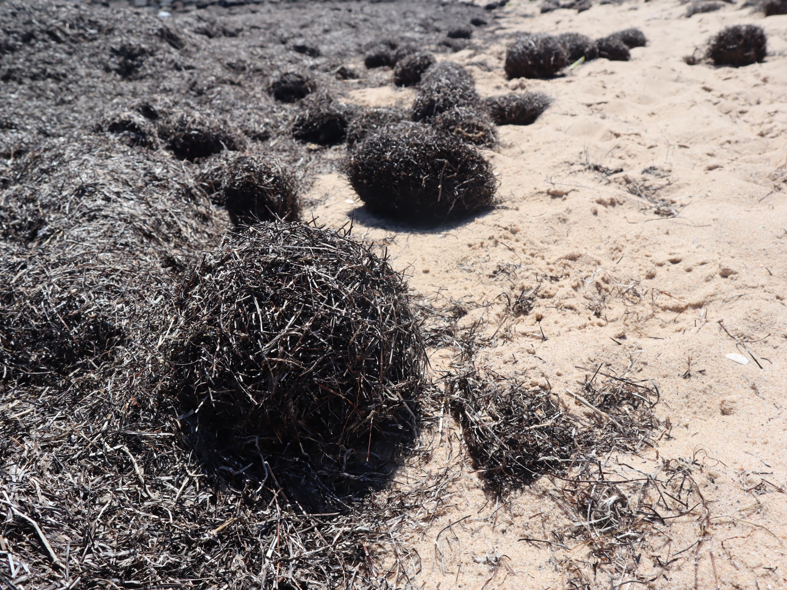
The Master Plan will review weed control, seasonal accumulation of sea grass wrack and other management actions to protect and enhance the foreshore.


Read about the project scope and view the map by clicking on the drop down arrows below.
The Ramblers Road Foreshore Master Plan will provide a review of the 2007 Management Plan and include up to date information on the changes that have occurred at this location as outlined above. The plan will provide an overarching vision for the management of Ramblers Road Foreshore Reserve and outline the desired outcomes and priority actions to be implemented in protecting this dynamic beach environment. It will provide stakeholders with an opportunity to identify values, issues and opportunities to help enhance management of the area.
Ramblers Road Foreshore Reserve and associated residential area is located south-west of Point Richards at Portarlington, approximately 25km east of Geelong on the Bellarine Peninsula. The foreshore reserve extends approximately 1.1km west of the existing pier and boat ramp at Point Richards and is approximately 30m wide.
The foreshore reserve is freehold land owned by the City of Greater Geelong. The site is zoned Public Park and Recreation Zone (PPRZ) in the Greater Geelong Planning Scheme, extending 600m out into the bay. The area south-west of Ramblers Road is zoned Public Conservation and Resource Zone (PCRZ) again extending approximately 600m out into the Bay.
Parks Victoria is responsible for the recreational use of the waters of Port Phillip Bay and the Department of Environment, Land, Water and Planning is the Crown land manager which includes both the seabed to the high tide mark. Bellarine Bayside Foreshore Committee of Management manage the Point Richards boat ramp and surrounds, car park and jetty as well as the foreshore Crown land east of Point Richards Road. There is also a section of Crown land foreshore to the west of the boat ramp and rock groyne that is managed by Bellarine Bayside.
The Ramblers Road Foreshore Reserve is directly adjoined by 56 residential lots with dwellings on 52 of these. There are also four public access points/walkways providing access from Ramblers Road through to the foreshore reserve. An unsealed walking path improving public access has also been installed along the foreshore reserve. This has led to increased public use of the Reserve and beach which had previously been available for use by mainly adjoining residents.
Figure One: Location of Ramblers Road foreshore, Portarlington (highlighted in red)

Figure Two: Ramblers Road foreshore and surrounds - zoning and land management.
City - Ramblers Road Foreshore
Bellarine Bayside Foreshore Committee of Management - Point Richards boat ramp, groyne and triangle of foreshore west of groyne (yellow star)
Your feedback is important to us. Complete our Ramblers Road Foreshore survey to help us capture your ideas and thoughts.
Feedback closes on 5pm Friday 10 February, 2023.
We invite you to attend an Open House session:
Online:
5pm-6pm Thursday 12 Jan
5pm-6pm Tuesday 7 Feb
Friends of Ramblers Road: 9am-11am Sunday 15 Jan
Portarlington Sailing Club, Point Richards Rd
Keep engaged with the Ramblers Road Foreshore Master Plan project by clicking the +Follow button at the top of the project page.
We also invite you to keep the conversation going with us and others by commenting on what you love about the foreshore and your vision for how it could be, by taking our survey.
The personal information requested on this page is being collected by City of Greater Geelong for the purpose of the Ramblers Road Foreshore Master Plan or any other directly related purpose. If the personal information is not collected, we may not be able to contact you for further questions or solutions. Your personal information will only be disclosed to carry out a deeper analysis of the data or as required to do so by law. Our privacy policy is available on our website. If you wish to alter any of the personal information you have supplied to City of Greater Geelong, please contact us by sending an email to privacy@geelongcity.vic.gov.au.
*In order to gain a deeper understanding of the data provided to the City and improve our services to you, we may disclose the information you provide to us to AWS Comprehend which carry out analysis of the data. Your personal information may be disclosed to AWS Comprehend based in Sydney only in relation to the primary purpose of collection. View the following link for AWS Comprehend’s Data Privacy statement.
![]()
Have questions or want to learn more about a project, contact us below:
| Phone | 03 5272 5272 |
|---|---|
| Website | www.geelongaustralia.com.au/contact/ |
The National Relay Service is available as a phone solution for people who are deaf or have a hearing or speech impairment.

We Acknowledge the Wadawurrung People as the Traditional Owners of the Land, Waterways and Skies. We pay our respects to their Elders, past, present and emerging. We Acknowledge all Aboriginal and Torres Strait Islander people who are part of our Greater Geelong community today.


